
CARI-Soils4Liberia Project Concludes Technical Reviews of Submitted Soil Profiles, Introduces New Digital Feature to Strengthen Field Survey Work
SUAKOKO, Liberia – The Soils4Liberia Project convened field surveyors, team leaders, and technical staff from the Central Agricultural Research Institute (CARI), the University of Liberia, the Ministry of Agriculture, the International Institute of Tropical Agriculture (IITA), and the Hungarian University of Agriculture and Life Sciences (MATE) for a two-day technical review and capacity-building workshop aimed at strengthening soil survey operations across Liberia.
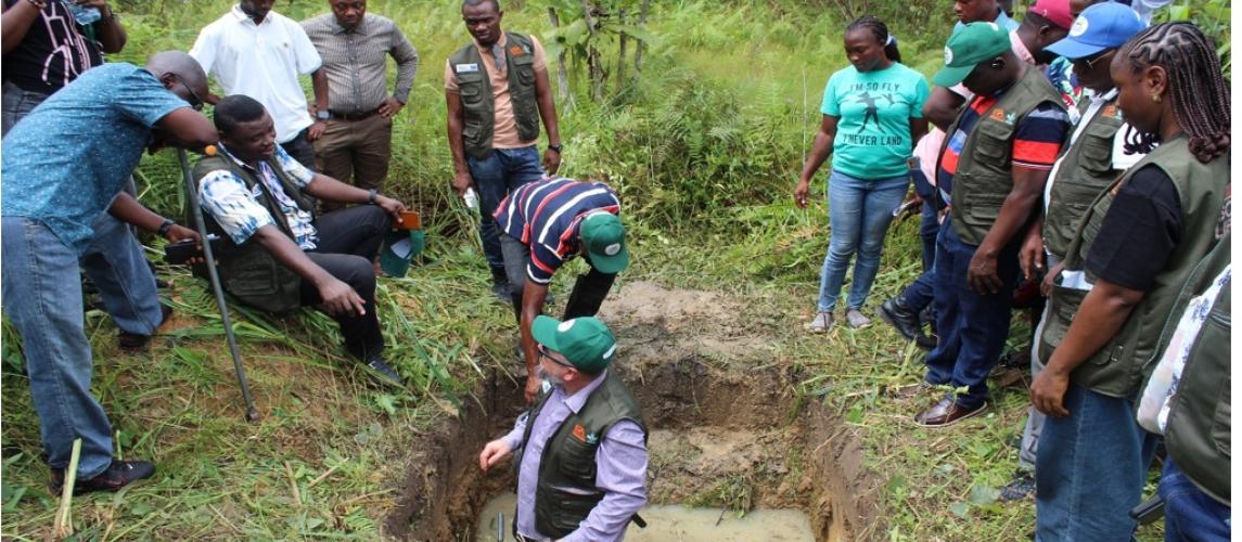
Held on November 2-3 in Suakoko, the session afforded participants the opportunity to refresh their understanding of soil genesis, observation, and classification while reviewing submitted soil profile records and introducing a new soil-profile feature within the Soil Data Management Tool (SDMT).
Welcoming participants on behalf of CARI Director General Harris P. Yanquoi, the Head of CARI's Natural Resources Management Program and Soils4Liberia Project Lead emphasized the importance of maintaining high-quality soil data collection standards to support the project's objective of developing an accurate and comprehensive national soil information system for Liberia.
Dr. Ádám Csorba and Dr. Yuri Andrei Gelsleichter, soil scientists from the Hungarian University of Agriculture and Life Sciences (MATE), provided technical leadership and training under the Soils4Liberia Project to support the generation of a national soil atlas for Liberia.
The technical sessions, led by experts from MATE, including Dr. Gelteicher who delivered an in-depth presentation on soil genesis and landscape processes. Participants examined how weathering, sediment transport, iron accumulation, and water movement influence soil formation and development across different landscapes.
The presentation also explored soil development along a catena, highlighting the interactions among topography, drainage, and soil properties. It also highlighted iron concentration processes, the role of water in soil formation, and the life cycle of plinthite, a common iron-rich soil material found in tropical environments. Discussions further reinforced field protocols, standard operating procedures (SOPs), and best practices for soil observations and classification.
In a virtual presentation, Dr. Csorbo, representing MATE, provided a detailed overview of ongoing soil survey activities and led participants through a comprehensive review of soil-profile records submitted to the SDMT platform. The session focused on identifying common challenges encountered during field observations, reviewing data quality concerns, and clarifying technical issues that require greater attention in future surveys.
Dr. Ádám Csorba is an Associate Professor in the Department of Soil Science, Institute of Environmental Sciences, at the Hungarian University of Agriculture and Life Sciences (MATE). His research specializes in soil spectroscopy, particularly the use of visible, near-infrared (VNIR), and mid-infrared (MIR) technologies to analyze and predict soil properties. Other key areas of expertise include artificial intelligence and chemometric methods for soil data interpretation, digital soil mapping and soil information systems, and remote sensing applications in soil science.
Participants also received practical training on the newly introduced soil-profile feature within the SDMT system. The enhancement is expected to improve the accuracy, consistency, and efficiency of soil profile documentation and reporting by field teams.
Through interactive discussions and submission reviews, surveyors and supervisors had the opportunity to raise questions from their field experiences and receive guidance from technical experts. The workshop also provided a platform for harmonizing field procedures and agreeing on practical recommendations to improve the quality and reliability of soil data collection moving forward.
The event concluded with a renewed commitment among participating institutions to strengthen collaboration, uphold standardized soil survey methodologies, and ensure the generation of high-quality soil information that will support sustainable agricultural development, land-use planning, and natural resource management in Liberia.
The Soils4Liberia Project is a collaborative initiative involving CARI and national and international partners working to improve soil knowledge and soil mapping across Liberia through modern survey techniques, digital tools, and scientific research.
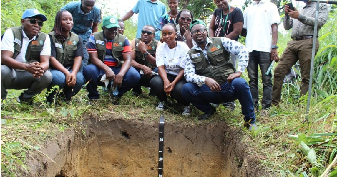
Field surveyors and technical experts align on soil data collection methods at CARI under the Soils4Liberia Project.
Field surveyors and technical experts align on soil data collection methods at CARI under the Soils4Liberia Project.
